


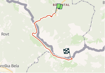

15.2 km | 30 km-effort


Tous les sentiers balisés d’Europe GUIDE+


FREE GPS app for hiking
 SityTrail
IGN / Geographical institutes
SityTrail World
The world is yours!
Trail On foot of 9 km to be discovered at Carinthia, Bezirk Klagenfurt-Land, Feistritz im Rosental. This trail is proposed by SityTrail - itinéraires balisés pédestres.
Trail created by ÖAV – Sektion Klagenfurt.
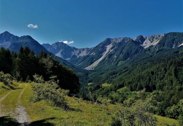
Nach ca. 1 Stunde Bergwanderung gibt es keine weitere Wasserstelle!


On foot

On foot